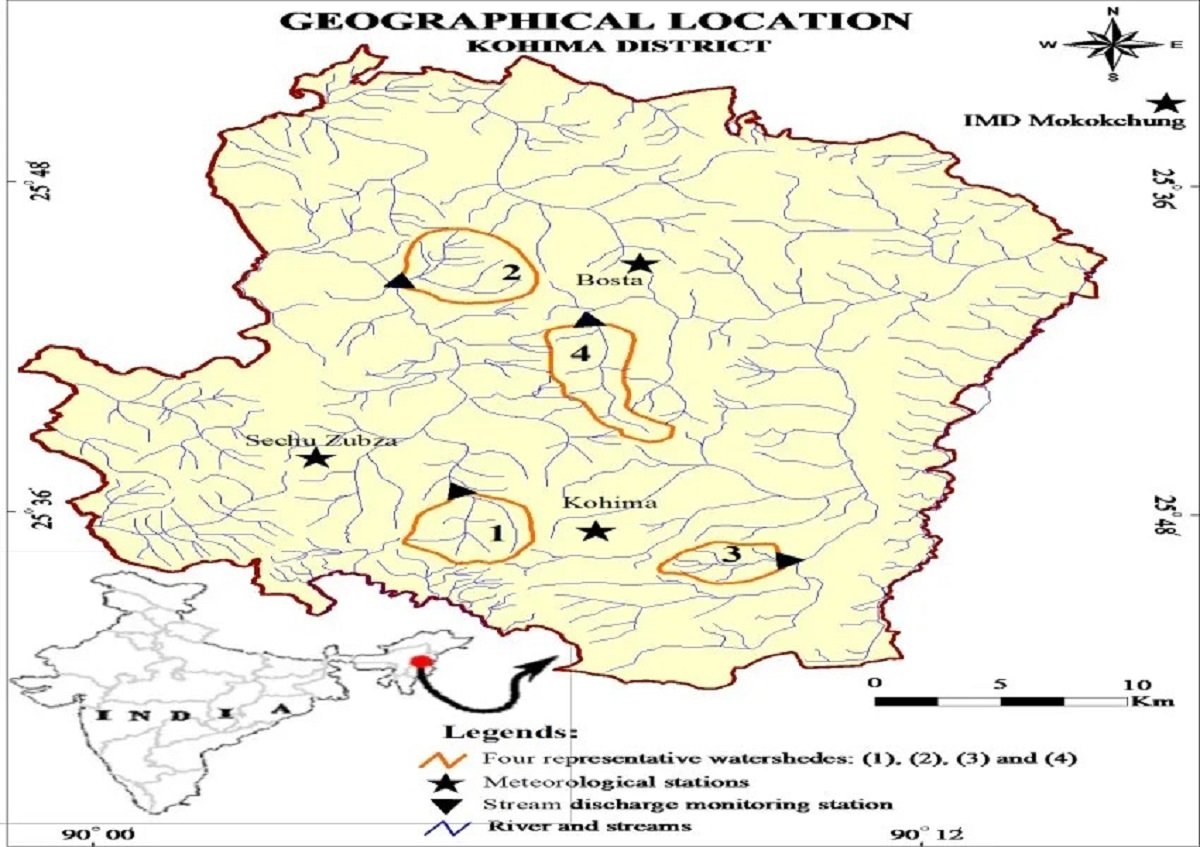
Nagaland University researchers conducted a pioneering GIS-based hydrological study examining the effects of geo-ecological conditions and human activities on runoff and river flow in the Northeastern Himalayan region, addressing significant data gaps and debates in the scientific community. The research focuses on the hydrological impacts of land use change, including river discharge, floods, and environmental degradation. It introduces a practical four-zone runoff classification—low, moderate, high, and very high runoff zones—to aid in water resource planning, flood mitigation, and integrated watershed management. The methodology and findings aim to inform policymakers, planners, and local communities and serve as a model for similar vulnerable regions in the Himalaya and India. Prof. Jagadish K. Patnaik emphasized the importance of this research for understanding runoff patterns, flood risks, and sustainable water management in fragile ecosystems. The study, titled ‘GIS Modeling to investigate geo-ecological and anthropogenic impacts on runoff and river flow in the North Eastern hilly region of India’, was led by Dr. K. Belho and Prof. M. S. Rawat from Nagaland University, with cooperation from Dr. Pradeep Kumar Rawat of Asian International University, Imphal, and received funding from Nagaland University and support from the Ministry of Tribal Affairs, Government of India. The findings were published in the International Journal of Geographic Information System Research and Development.
Nagaland University Study Provides Benchmark Data on Land Use Change and River Flow in Northeastern Himalayas